We stayed in Pt Augusta until lunch time to have a catch up with Briony who was travelling back to Adelaide to fly back to Qld. She after had a couple of nights in Hawker for the Hawker race meeting, which by the way was cancelled. Although the races were cancelled the bar was open and the other events continued - a good time was had by all.
Westward bound we left Port Augusta in the rear view mirror and travelled towards Western Australia with our first night stop only 68km at Iron Knob in the town RV park. Weather was wet, cold and windy, so out with those winter clothes!!
We continue west on the Eyre Hwy turning off just after Wudinna and headed to Port Kenny (Venus Bay). In January, when we had visited Eyre Peninsula, we only travelled up the west coast as far as Elliston so wanted to visit the northern section of the coast. We were lucky enough that the clouds had broken up and the sun was shining on Venus Bay which looked a picture with the blue sea.
 |
| Looking across Venus Bay from Port Kenny |
After driving around Port Kenny, both streets, we continued to Murphy's Haystacks about 25km from Pt Kenny and 38km south of Streaky Bay.
Murphy's Haystacks -
These unusual rocks formation aquired their name from a Scottish agricultural expert who advocated that to produce good hay farmers should harrow their land for the best results. While travelling with the coach he noticed the rocks in the distance and informed the coach driver and passengers that this farmer harrowed his land to produce so much hay and fodder. Being located on Mùrphy's property they become known as Murphy's Haystacks. From then on passing coachmen described them as haystacks to their passengers. However the Haystacks are described technically inselbergs (a hill that looks like a rocky island rising sharply from the sea).


The clouds came over while we were at Murphy's Haystacks so decided that this would be a good spot for tonights camp and I might get some nice photos in the morning sunlight. As the clouds came over the night set in and eventually the rain started. During the night we had several showers of rain and woke to a very dark cloudy morning, not what I was hoping for to get some photos of the Haystacks.
The rain had passed but the sky was cloudy and had a real chill in the air as we arrived in Streaky Bay, in time for a coffee at the bakery. It had been some time since we had been in Streaky Bay so a drive around to some of the new housing estates you could see how the town was developing - would be good to return here when the weather was wamer. The next town we drove through was Smoky Bay, a small deviation from the main road before turning back onto the Eyre Highway to Ceduna.
 |
| Smoky Bay jetty |
We arrived in Ceduna and stayed at Shelly Beach CP which had been recommended by fellow travellers. Was a nice park south of Ceduna while we prepared for the next few days across the Nullarbor. We cooked up some of our vegetables as there are quarantine restrictions going into WA. From our site we walked over the sand dune to a spectacular view of Bosonquet Bay. Also had a drive around Ceduna visiting Fish factories at Thevenard, Conveyor and Wharf, Pinky Point Lighthouse, the Foreshore in Ceduna (where we sat under the trees after completing our half way around Australia trip in 1980 in the Holden Panel van!!)
The next day we had morning coffee at Penong which is known for its windmill display, in particular Australia's biggest windmill. Continued onto Head of Bight and Nullarbor with the temperature slowly winding up to 18 degrees but a chill factor in the wind.
 |
| Windmill display including the largest one in Australia |
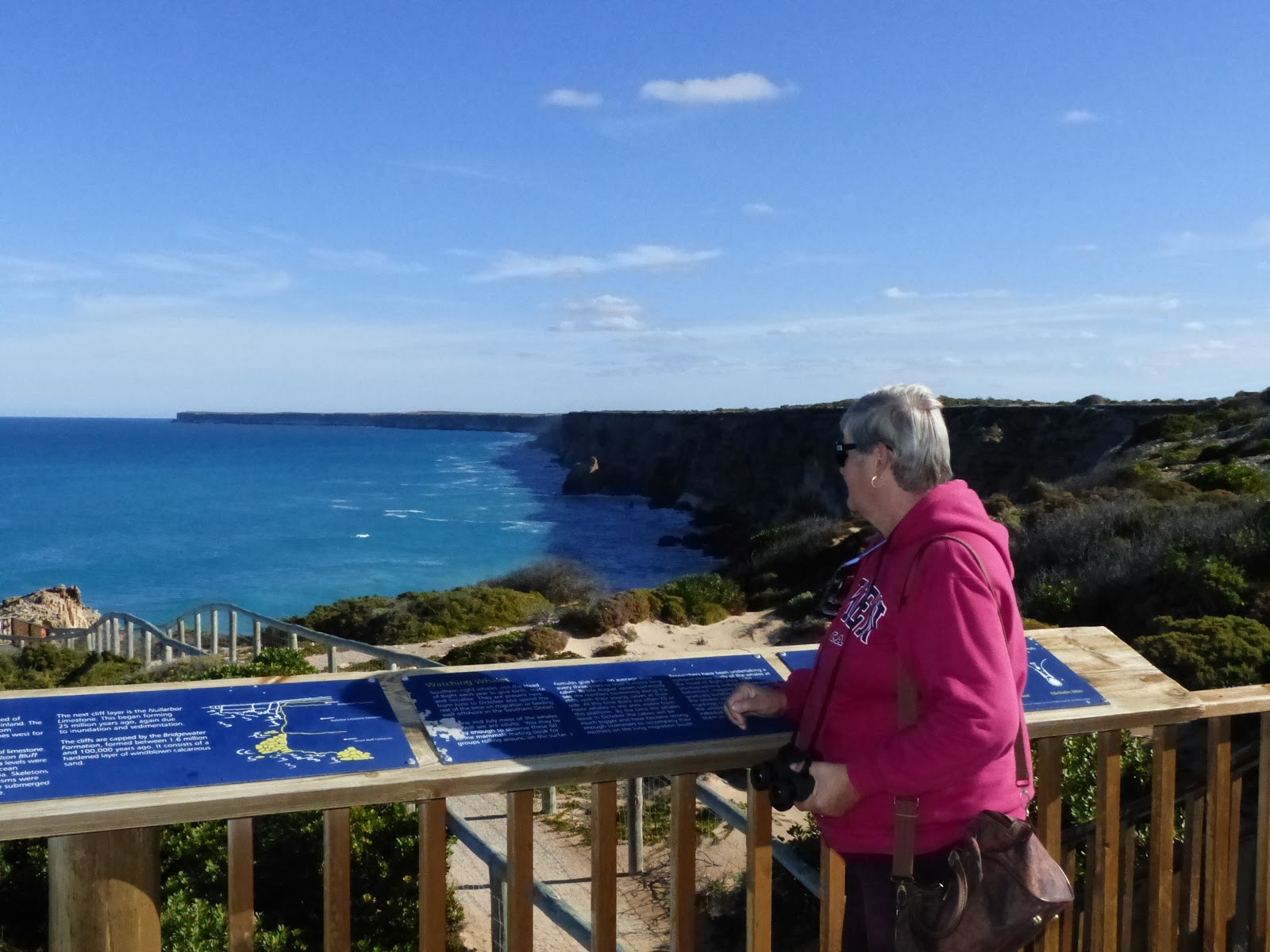
The sign at the turn off into the viewing area at the Head of Bight indicated 5 whales had been sighted that day, so we thought we would be in luck to see some whales! We did see one some distance from the viewing area and was able to admire our first view of the Great Australian Bight his trip. Most impressed with the walkways giving people a great view of the whales, if they were around!).
 |
| Helen at Head of Bight viewing area |
 |
| Yes we did see a whale - look closely! |
 |
| View of the Bight near Nullarbor |
 |
| Bush camp sunset approx 20kms west of Nullarbor |
After filling up with diesel at Nullarbor ($1.72 litre) we had a bush camp about 160km from the WA boarder - found a nice spot out the back. From here we continued west, powering into a strong side wind which didn't help with the fuel economy, stopping at the SA/WA border quarentine station to hand over the fruit and vegetables as well as the honey!! This didn't go down well with Helen as she LOVES her bush honey with breakfast, so I'll have to endure the mumbles for the next few days until we find some more pure honey. Also the time difference will take a few days to get used to.
That night we stayed at a bush camp about 20km east of Madura. We pressed on the next day and travelled the 146.6km straight stretch of road, this is the longest straight road in Australia. I couldn't convince Helen to drive as she said she had driven this stretch of road more times than me, well we are even now both driven it twice!
 |
| The sign says it all! |
We had thought of staying at a spot we had previously camped, however was not as appealing this time as the back area was fenced off, so pressed on to find another camp site. We eventually found a great camp and was able to get into the bush away from the road, a nice camp for the last night on the Nullarbor crossing.
 |
| Last bush camp on the Nullarbor approx 150kms east of Norseman |
In the morning we made our way into Norseman, fueled up at a more reasonable price ($1.399/litre) then headed north onto Goldfields Highway, hopefully to warmer weather, and Kalgoorlie.