The Wandering Tops

The Wandering Tops

24 November, 2013

Stirling Range & Porongurup NP

Stirling Range National Park is 80km north of Albany, the range stretches east-west and is surrounded by cleared farmland and at this time many grain trucks and road trains travelling on the roads.

Stirling Range NP, Bluff Knoll

Harvest time, not good for the hay fever

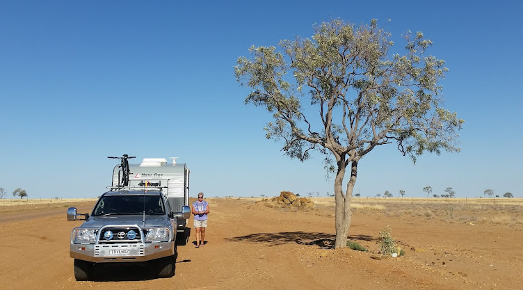
Moingup Spring Camp area

We decided to stay in the National Park camp, Moingup Spring, rather than one of the two caravan parks in the area. After collecting the park brochure we planed on taking a drive through the park on the Stirling Range Road after walking one of the trails, mostly to mountain summits.  Of the 6 bushwalk trails we chose Mount Trio as this was classification 4 in the brochure and has a man walking on a slight grade with walking stick.  The description read "first third steep but the remainder is easy", so that sounded ok, especially two thirds easy!!

Mt Trio, we got at least two thirds up the mountain
We drove to the car park early morning and looked up at Mt Trio at the trail leading up the mountain, gulp, this does seem quite steep.  As we approached the trail the path looked great for the first 20m but the sign at the start had this little man indicating the classification carrying a back pack, which means its a classification 5 higher than first read in the brochure, gulp, my thought was are we doing the right thing, but with Hels very confident to get to the top strode off up the path.

Track looks great at the start.

Still powering on, steeper than piccie shows

About 10 minutes up the side of the mountain we stopped for the first break and already the path was quite steep, but had well formed stairs, so we took in the view and reassured each other that this would be ok.  After another 2 or 3 stops up the hill side we had made it more than half way, I said it looked as though it was getting flatter so we pressed on.  Then we came across another steep section and Helen decided that this was enough for her mumbling something like if she was a mountain goat she would have 4 legs!!!. 

Rest time, but look at the view.

I can do this, nearly there .... I think!
I thought, I'm very close to the top and it looks as though we are nearly there, "I can do this" so off I go however just around the corner it became even steeper and I was watching my footing on each step as I progressed up the hill side.  As I moved on I came to a section which was a little flatter and I could look further along the path.  As it was early morning there was a lot of shade on the path with sections of sun between the trees.  It was at this point that I came to an unmoveable object on the track .............. a black snake.  I was within a metre or so of this snake sunning on the path when I saw him.  Lucky for me the path was relative flat and I started to look further ahead but he was most intent, no bloody stubborn, and was not going to move from soaking up the warm sun on the path. I thought I would throw a couple of large stones to move the bugger on, but this was no good, he was really intent on staying on the path in the warm.  My choices seemed simple, I could jump over the 5 foot venomous black snake or retreat back down the hill.  I choose to retreat down the hill.

WOW that's some road block, move you bugger

Hels made it back to car park before me.
Helen had already made it back to the car when I reached the bottom of the hill, she thought I looked pale from the climb until I told her about the impassable road block I had encountered.  After a cold drink we caught our breath and decided that that was enough of mountain walking trails for a while.

From here we continued on the drive around Salt River Rd to Stirling Range Rd.  The drive through the range had many wildflowers to be seen and various lookouts to take in the views of Mt Trio and the others in the park.  At lunch time we stopped at White Gum Flat picnic area, it was so tranquil you could hear the serenity, it seemed we were the only ones in the park.

Heath-Leaved Honeysuckle

Another wild flower

Enjoying one of the old park benches at White Gum Flat picnic area.
We stopped at Central Lookout car park and noticed three 4WDs which must have passed us when we stopped to check out Talyuberlup picnic area earlier.  I started to walk up to the lookout when more 4WDs arrived -  so many that we were nearly blocked into the car park.  It was a tour group from WA 4WD Magazine of 12 vehicles, so much for our serenity!!  I headed quickly back to the car leaving the group at the look out and after manoeuvring out the car park headed back to our quite camp site for a red wine to rememorise the days activities.

What happened to our serenity
Next morning we headed towards Albany stopping at Porongurup National Park about half way between Stirling Range NP and Albany.  Porongurup NP has much taller trees, karri forest and open jarrah/marri woodlands than Stirling Range NP and is recovering from a wildfire in 2007 which burnt nearly 90% of the park.  After yesterdays adventures we decided that any walking to mountain summits were not on the to do list, so we choose to do the Bolganup Trail, this is classified level 3 and the sign has an adult holding a child's hand, so that seemed a good option.

Tall timber at Tree-in-the-Rock car park

Hels that's the wrong way

But did see some mossy trees

After taking the wrong trail to begin with (started heading up a mountain!!) we soon found the Bolganup Trail and enjoyed the 600m walk (much flatter). 


Big tall mossy trees

Back on the Bolganup trail

Even found a frog on a tree stump (Freddo chocolate!)
 As the walk stared from the Tree-in-the Rock car park we had to find the tree in the rock before heading to Albany.
Tree-in-the-Rock

Tree-in-the-Rock


19 November, 2013

Esperance & Cape Le Grand NP

Twilight Beach
We arrived in Esperance around mid day on Thursday, quickly set up and had lunch before taking a quick drive to get our bearings.  After travelling a short distance west along the Great Ocean Drive it became quite obvious that the next couple of posts are going to have lots and lots of bay photos.  Esperance is dubbed the 'Bay of Isles' and has it's beaches declared Australia's whitest, which I would have to agree. To the west the bays include Blue Haven Beach, Observatory Point, Ten Mile Lagoon and Twilight Beach which voted the 'Most Popular beach in WA' .

Esperance, looking west from lookout
The town seems like many other beach side towns with a population of around 10,000 people which would flourish during the summer months with the influx of holiday makers for the beaches and surf.  Esperance also has a large rural community and judging by the large number of grain trucks we saw on the road, would be very prosperous in supporting the region.

10 Mile Lagoon Beach - always a wind farm not far away.

On the Friday we completed the Great Ocean Drive (40km scenic ocean road) including a Wind Farm and a pink lake (which was not pink the day we visited - probably too cold so stayed blue!!).  We also checked out the streets of Esperance -  I bought a warmer jacket as the wind has not stopped.  You are probably wondering why no mention of swimming in the beautiful bays -  might look nice but the water is like ice and it is accompanied by a chilling wind!!

Saturday we made our way to Cape Le Grand National Park - we had heard much about the park and in particular Lucky Bay from fellow grey nomads, we had to go see.  After entering the park which is about 56km east of Esperance we drove towards Lucky Bay in anticipation of something special as it was voted 'the whitest beach'.  We came over the hill to view the bay and were absolutely gob smacked -  it was such a picturesque  bay.  To top it off there was even a coffee van on the beach, Hels thought she was in heaven!!!!

Our first site of Lucky Bay - photos just don't do it justice.
 
Coffee van on the beach .... how "lucky".


Lucky Bay was named by Mathew Flinders who used this bay as a safe anchorage on Saturday 9th January 1802 during his circumnavigation of Australia.

Our camp overlooking the bay

Lucky Bay from the opposite side to the camping area (3km walk)

Arriving  early we were able to get a beach front site, so set up and sat gazing at the sea while having lunch and a coffee (another magnificent front yard view).  On Sunday we had a rare day when the wind stopped and the temperature rose so we made the best of the day and visited some of the other bays in Le Grand NP, I even managed to jump in and have a swim. I didn't stay in long as the water was still on the chilly side, but I can say I've swam in Lucky Bay.  Our first Bay to visit was Thistle Cove not far from Lucky Bay where we had a quick look at Whistling Rock (still not sure if it whistles!) and  just before heading back to the car park I noticed some dolphins in the bay.  There seemed to be a pod of 4 or 5 which were having a real play, we watched for a while before moving quickly around to have a closer view of the bay where we stood in amazement while we watched  the dolphins having a 'whale' of a time in the clear turquoise water.  Even though we had seen dolphins before it was special to watch them at play.  We visited the other bays after but they didn't have the same wow factor.

Thistle Cove, look closely for the dolphins

This may help.
The warm weather and lack of wind didn't last long and we woke on Monday morning to an overcast day, some light showers and with winds from the south east again, so time to pack up and move on.

We heard Munglinup Beach about 110km west of Esperance had a sheltered camping area, so once we had stocked up on essentials in Esperance we headed off.  Munglinup Beach is boarded by a natural reef and if it was not so windy would have been a great place to stay and enjoy for a couple of days. The camp site was positioned behind the sand dune so that in its self made it a good sheltered place to camp for the night.  It was just so cold, particularly from the wind that the jeans came out and an additional couple of layers of clothes went on ....... I think we've come too close to the south pole!!!  The sun made a couple of attempts to come out without any great success so we'll note this beach for when it's warmer and hopefully stay for a few days.

Munglinup Beach, that far south the poler bears want a cuddle to keep warm!!
Travelling further east we headed for Hopetoun, another seaside town on the eastern side of Fitzgerald National Park.  On arrival to Hopetoun we drove straight into the biggest caravan wash bay I have ever seen, and gave the van a quick once over - she was certainly sparkling after.  Without the sun and with a blistering wind we had a coffee at one of the local shops, took in the sights of the town and decided to keep going, finishing up at Ravensthorpe for the night.

Now that's a big wash bay
 

13 November, 2013

Wave Rock to Norseman

On Sunday 10th we travelled with Colin & Yolande east along Coalfields Highway to Wagin (home of the big ram), stopped for lunch at Dumbleyung continuing along Fence Road passing Dudinin, Kulin, Kondinin before camping @ Wave Rock C/P.  Once set up we walked to the Rock and over it although did not feel like walking the 2km round trip.  Wave Rock appears very commercialised with Resorts, Speciality Shops etc.

Wagin's BIG RAM, not sure if Cindy thought it was her big brother.

Lunch stop at the Dumbleyung  Railway Station
Only stayed one night at Wave Rock however before continuing on we backtracked to the town of Hyden where we had a look around and was particularly impressed with 'Living Art Street Sculptures' which tells a story of the history of the area.

The sculptures start with the early settlers and moves though time

Early settlers arriving in the area

Story relating to history of Shearing in the are

Johnny the mechanic came to town

Had to take this piccie but can't remember the piece of history, the bike on the left represents the Hyden Taxi Circa 1929 - 1930.

Wave Rock is the start of The Granite and Woodlands Discovery Trail, a 300km track from Hyden to Norseman in the southern inland of Western Australia. It is a spectacular wildflower wonderland in the spring and offers many sites along the track with significant natural or cultural history.

Traditional Wave Rock photo
View from top of Wave Rock looking north across the salt lake.


Yep,  Hels at Wave Rock ...... really, on the level!!!
The Granite and Woodlands Discovery Trail has 15 sections of interest and is very well documented in a brochure available from the tourist information centre.  We didn't stop at them all as they include the State Barrier Fence (dog fence), Shire Boundary and several rock formations starting at Wave Rock.

Hyden to Norseman road, pretty dusty but generally good
One site of interest on the road was Forrestania Plots - during the 1920s the Western Australian Government hatched a scheme to establish 3500 farm plots from Hyden to the east to be settled by Australian and English migrants. In 1929 as a result of the Depression the scheme was abandoned. From 1960 to 1967 as a result from project manager Tom McDowell local farmers built a shed and started various cropping trials, although the trials provided some success, a change in government the funding was not available to continue and clearing was banned in WA so the land returned to its natural state.

This small shed is really know as McDowell House in recognising of the late Tom McDowell the driving force behind the Forrestania Plots project.

The section around the Breakaways has some great varieties of wild flowers including tall spindly flame grevillea, which would look spectacular when in full flower.  They weren't when we went past so no photo.

The Breakaways, a great camp spot with the contrasting colours of the sandstone.

McDermid Rock - had a walking track across the rock and evidence of early attempts to gather water for farming in the attempt to build a small dam in the rock.

We decided to camp at Lake Johnstone, 200km from Hyden. With plenty of room for both vans we overlooked the salt lake and stayed for 2 nights.

Our camp on the banks of Lake Johnson Lake

Colin got a bit toooo close to one of the water holes on the lake and took an unplanned swim .... or mud bath.

Some of the wildflowers present on the lake perimeter

We entertained our self buy swatting "March" flies and feeding them to the ants, they preferred them belly up!!
This section of road between Hyden and Norseman was well worth travelling along and the brochure was very informative making the 300km most interesting, particularly explaining the reason for the various changes in vegetation.

On Wednesday we headed into Norseman and stayed at the Gateway caravan park.  We had dinner at the Motel next to the park as Colin and Yolande were heading across the Nullarbor to Adelaide, and we were continuing south to Esperance the next day.